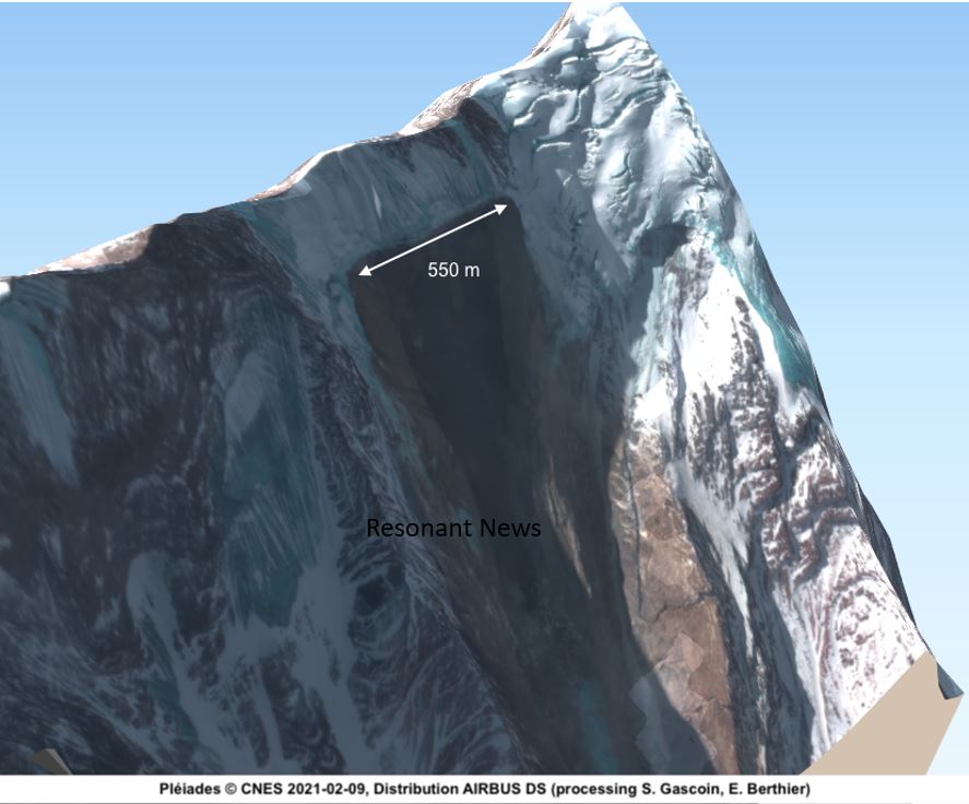
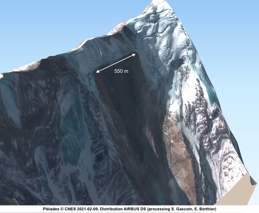
A recent report by French space agency (CNES) shows a 550m wide rupture which caused the disaster at Chamoli, Uttrakhand.
From the report:

Article by Levina
The French space agency (CNES) activated the International Charter “Space and Major Disasters” to image the area of the disater in Uttarakhand. Pléiades images (resolution: 70 cm in panchromatic, 2.8 m in multispectral) were acquired today 09 Feb 2021, two days after the event. These images show the detachment area with a clear rupture line of 550 m on the north face of Ronti. The French space agency (CNES) activated the International Charter “Space and Major Disasters” to image the area of the disater in Uttarakhand. Pléiades images (resolution: 70 cm in panchromatic, 2.8 m in multispectral) were acquired today 09 Feb 2021, two days after the event. These images show the detachment area with a clear rupture line of 550 m on the north face of Ronti.

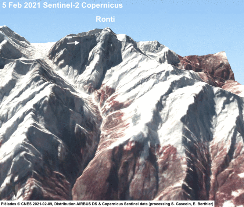
This is a comparison with the latest Sentinel-2 image, before the flood.


Preliminary work by many scientists suggests that a rockslope failure released a mixture of rock and ice which created a potent flood in the valley of the Rishiganga River.
UPDATE 10 Feb 2021. A Pléiades stereo pair has been acquired (B/H = 0.12) which allowed us to generate a high resolution 3D model of the area.

Update 11 Feb 2021
Two elevation difference maps were computed by Etienne. A first one by differencing the above Pléiades DEM with the Copernicus 30 m resolution DEM
Then, D. Shean (Univ Washington) computed a pre-event DEM from WorldView-1 images which allowed a finer analysis. The estimated detached volume is 25 millions cubic meters.
The above report belongs to series temporelles.
Meanwhile a team of scientists were flown to Dehradun after the glacier burst in Uttarakhand. The scientists, belonging to the Snow and Avalanche Study Establishment (SASE) of the Defence Research and Development Organisation (DRDO), were flown to the Uttarakhand capital, on Sunday night.

Leave a Reply